

Hiking Mount Toubkal in the heart of Morocco’s Atlas Mountains is quite literally a breathtaking experience. Whether you’re a local or a travel-savvy hiker looking to make your trip to Morocco more memorable, the 4167m (13665ft) high peak is one peak worth checking off your bucket list.
The experience, while absolutely incredible, can be tough and there are things you should know before setting off to the highest mountains in North Africa. We cover gear, clothing, and food in the guide below.
Dov’è he rides Toubkal?
Located in the High Atlas Mountains, Mount Toubkal is the highest peak in the Toubkal National Park. The Atlas Mountains create a barrier between the hot Sahara Desert and the cool Atlantic Ocean. Of the many great hikes in the Atlas Mountains, Mount Toubkal is the most popular.
Most treks start at the foot of the rugged mountain range from Imlil village (1740m above sea level). Reach Imlil from Marrakech on a guided tour or take a large taxi (shared taxi) to the starting point outside the village of Hotel-Cafe Soleil. You can meet your guide here on the day of your excursion.
Imlil has small shops and vendors selling food to visiting hikers. Most of the accommodation options can also accommodate your culinary needs if arranged in advance. If you find it, the goat and lamb chops are a delight.
How difficult is it to hike the Atlas Mountains?
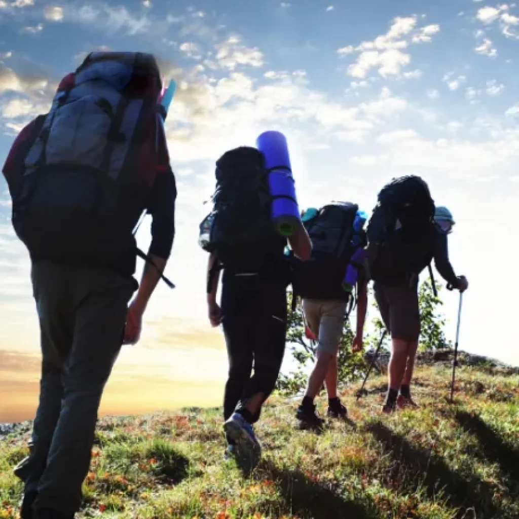
The route to the top of Mount Toubkal is a non-technical hike, meaning you won’t need a rope to reach the top. It is vital to have a licensed guide to make your trip safe and informative. The heat in the summer, the snow in the winter and the rough surfaces on the steepest slopes make it a test of both mental and physical endurance.
The rugged terrain means that most operators have imposed an age limit of no less than 16 years. While other operators accept children from the age of 10, they require the child to be able to complete the challenging 2425m drop.
The altitude is a challenging part of reaching the summit and it is difficult to tackle on your own. Air pressure decreases as you climb in altitude, with 3% less oxygen in the air for every 1000 feet of ascent. This means your body will have to work harder to absorb the same amount of oxygen.
How long does it take to hike Mount Toubkal?
While experienced and fit hikers can hike Mount Toubkal in two days, the altitude and incredible area make it better suited for four days. It allows you to enjoy Imlil before reaching the summit or hiking to nearby peaks as well. The typical itinerary of a three-day hike to Mount Toubkal is explored below.
Day 1 Reach the village of Imlil and settle into your accommodation. You can explore the area on foot, but remember to rest up before your big hike. If you’ve booked to stay and eat at the refuge, you should be able to pack everything you need into a backpack. Alternatively, your guide can arrange for a porter and mule to carry your belongings to the refuge.
Day 2 The early stages of the hike are easy to manage with just a gradual change in elevation. You will pass another village (or two) on your way. Your goal for the first day is to reach the CAF Refuge or Les Muflons at 3207m above sea level, where you will spend the night before setting off for the summit the following morning.
Both refuges offer a limited number of rooms and dormitory bedrooms. However, during the popular periods, it can be more relaxing to camp outside. Your body is likely to fall asleep quickly as it typically takes hikers five to eight hours to complete the first day’s hike (slow and steady wins the race).
Day 3 Wake up early for the best conditions to reach the summit – everyone else in the shelter will also get up early. Starting in the dark at 5am makes it necessary to have a headlamp, as you’ll want to have both hands free. The route is harder on the second day, with scree (fragments of broken rock) on the steeper slopes, requiring the use of trekking poles for the ascent and descent.
After the scree, the route becomes more defined while remaining steep. The altitude will begin to affect your oxygen intake, so keep moving at a steady pace (as slow as possible). A metal pyramid marks the summit and, once visible, will motivate you to push yourself to the top.
After about four hours of walking you will have made it! Then you can soak up your surroundings and snap a photo at the top with your team before setting off back down. Remember to share a few words of encouragement with the other hikers you pass.
After two hours, you should reach the refuge where you can choose to spend another evening, or you can continue down to Imlil.
When to hike Mount Toubkal
Although snow along the route in the winter and warmer temperatures in the summer make the trek more difficult, Mount Toubkal can be hiked all year round. The best season to approach Morocco’s highest peak is spring, which is still the busiest time. When trekking in the high mountains it is best to be prepared as conditions can change rapidly.
Spring In the months of March to May temperatures in Imlil reach lows of -1.8℃ (28.7℉) while highs reach 16.7℃ (62.1℉). You can expect light snowfall, very little rain, and comfortable temperatures.
Summer In summer, between June and August, the High Atlas Mountains experience average temperatures of 17℃ (64℉) and maximum temperatures of 24.8℃ (77℉). July is typically the hottest month and adds to the challenging conditions in the mountains.
Fall In Imlil, the maximum temperature between August and October is 23.5℃ (74.3℉) with a minimum temperature of 3.8℃ (38.9℉). The weather is pleasant, with small amounts of rain and snowfall heading into winter.
Winter During the winter, the mountain tends to be less crowded. However, conditions can be more challenging when the lower slopes of the mountain are covered in snow. Between the months of December and February, Imlil has average temperatures of 0.4℃ (32.7℉) and experiences a minimum temperature of -4℃ (24.7℉).
Safety tips
One of the most significant risks while hiking Mount Toubkal is due to the high altitude reached during the hike. Altitude sickness causes low oxygen saturation levels that lead to headaches, stomach pain, and nausea, among other symptoms.
The best way to prevent altitude sickness is to give yourself time to adjust, drink water, and get enough sleep. Also, acetazolamide is a medicine that can be prescribed by the doctor.
Alongside a map of the area and a compass, it is important to carry a first aid kit with antiseptic wipes, plasters, bandages and disinfectant wipes. It’s essential to stay hydrated and while bottled water is available along the way and the streams have clean water, it’s best to use a survival straw to filter your water and prevent upset stomachs.
0 Comment